
Maps, Atlases, and Geospatial Data

A selection of geographic maps, atlases, and geospatial data recommended for the study of Northern Quebec, Northern Canada, and the circumpolar North.
Some of the documents and data are freely available while others are restricted to members of the universities mentioned (restricted access), and are available under institutional licenses only. Atlases available in print format only are also recommended.
To consult the various categories and subcategories that this collection contains, use the filter Collection.
Resources
L’Apparition du Nord selon Gérard Mercator (Université Laval)
Available to all | UQAM (Print book) | UQTR (Print book)
Web platform that offers an interactive reading of the first printed map (1595) of the circumpolar North.
Collection(s): *** Maps, Atlases and Geospatial Data ***, Maps and Atlases, Circumpolar North
Free - Open Access, Print Document, Humanities and Social Sciences
Subjects: Maps, Cartography, Gerardus Mercator, Circumpolar North, Polar projection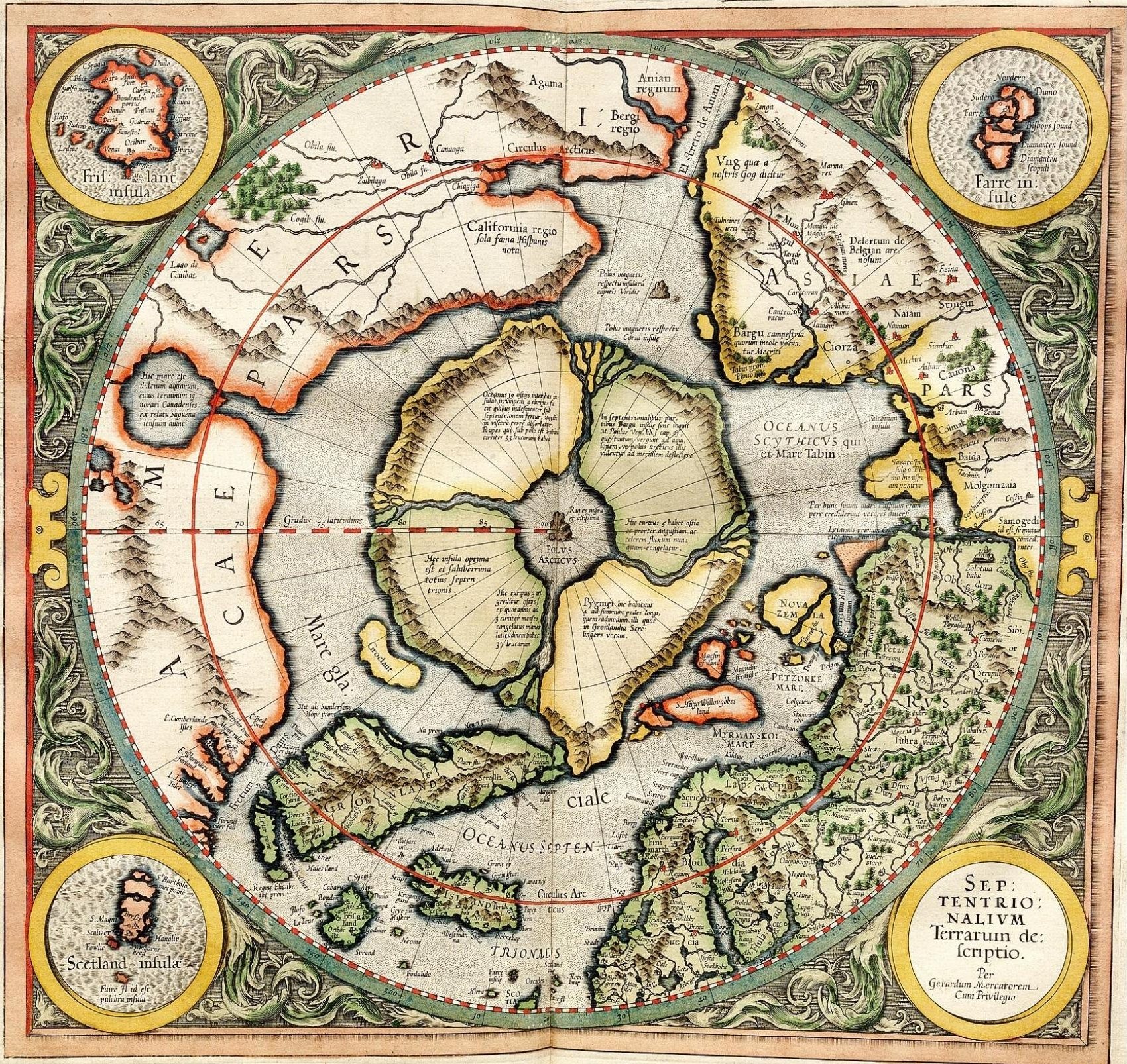
Map of the Kativik region (BAnQ)
Geographic map (scale 1: 1,000,000) of the Kativik region illustrating, among other things, the ancient settlements with Inuit, Cree and Naskapi toponyms.
Collection(s): *** First Peoples of the North ***, Maps, Atlases, and Geospatial Data, Map and Atlases, Northern Quebec, *** Maps, Atlases and Geospatial Data ***, Maps and Atlases, Northern Quebec
Free - Open Access, Humanities and Social Sciences
Subjects: Maps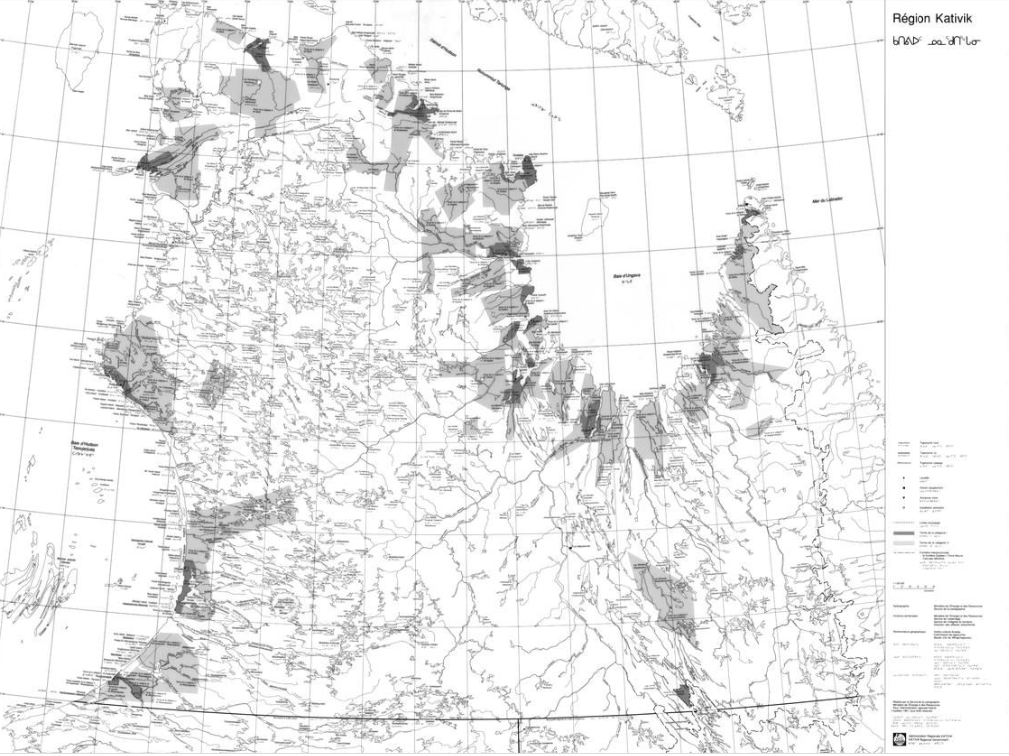
Maps - United States Arctic Research Commission
Maps and geospatial data of the boundaries of the Arctic.
Collection(s): *** Maps, Atlases and Geospatial Data ***, Maps and Atlases, Circumpolar North
Free - Open Access, Natural Sciences
Subjects: Alaska, Maps, United States, Arctic boundary
Maps of mining activity in the James Bay and Ungava regions (BAnQ)
Group of geographical maps that compile information relating to mining activity in the James Bay and Ungava regions.
Collection(s): *** Maps, Atlases and Geospatial Data ***, Maps and Atlases, Northern Quebec
Free - Open Access, Natural Sciences
Subjects: Mine exploration, Mining, Mines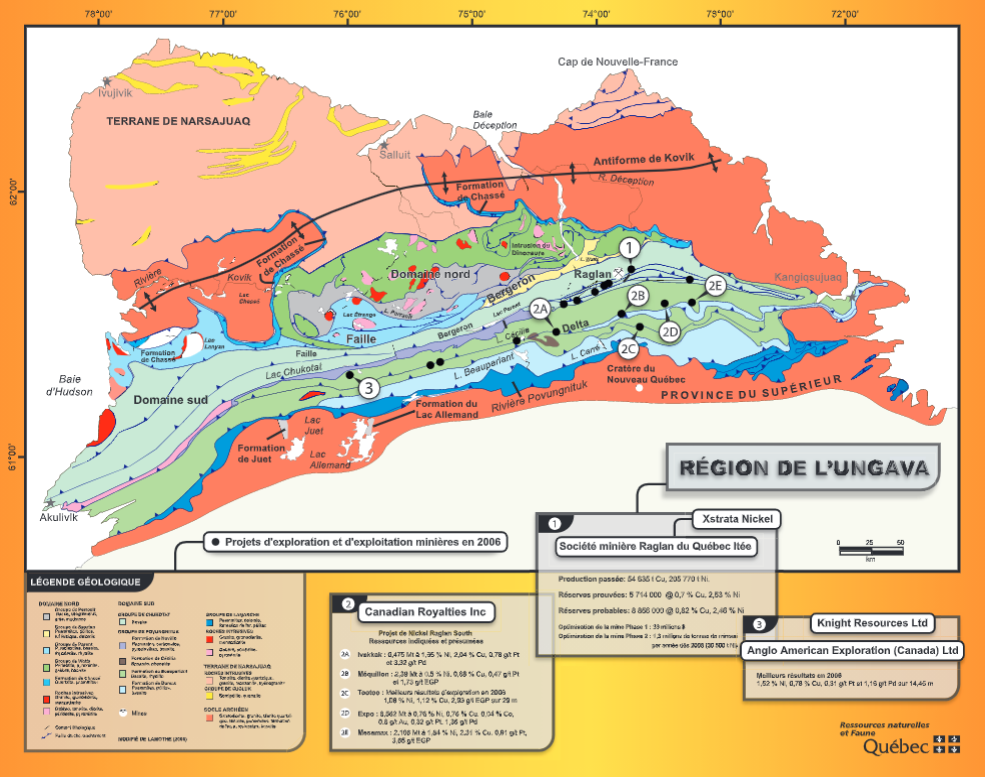
Maritime jurisdiction and boundaries in the Arctic region (Durham University)
Map of maritime zones and Arctic boundaries.
Collection(s): *** Maps, Atlases and Geospatial Data ***, Maps and Atlases, Circumpolar North
Free - Open Access, Humanities and Social Sciences
Subjects: Maps, Territorial waters, geopolitics, Maritime juridiction
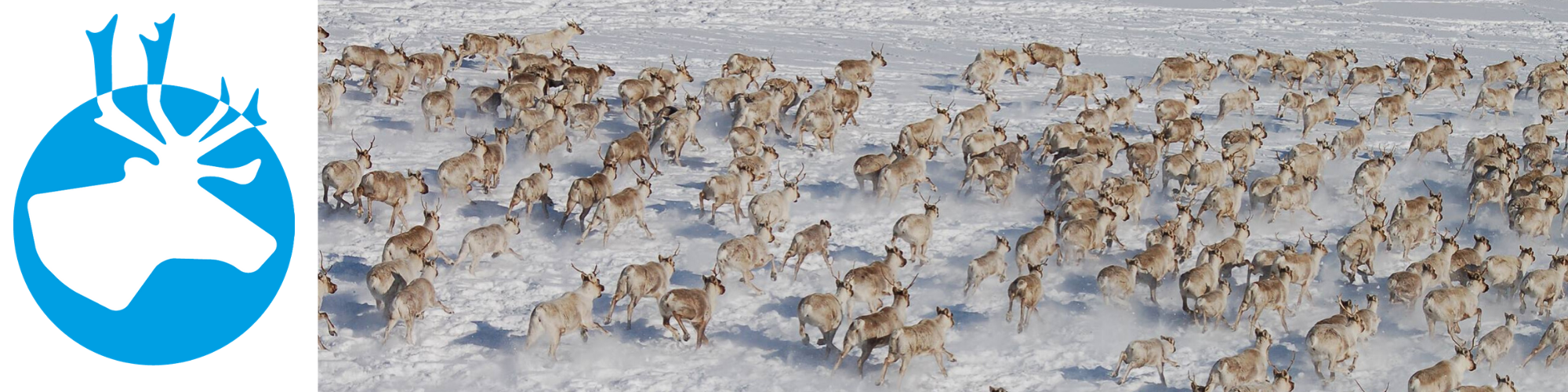
Mise bas du caribou (Géoindex)
Concordia (Reserved Access) | INRS (Reserved Access) | Laval (Reserved Access) | McGill (Reserved Access) | UQAM (Reserved Access) | UQTR (Reserved Access)
This layer shows the location of caribou calving grounds north of the 52nd parallel.
Collection(s): *** First Peoples of the North ***, Maps, Atlases, and Geospatial Data, Geospatial Data, Northern Quebec, *** Maps, Atlases and Geospatial Data ***, Geospatial Data, Northern Quebec
Reserved Access, Natural Sciences
Subjects: Calving grounds, Caribou, Geospatial data, Northern Quebec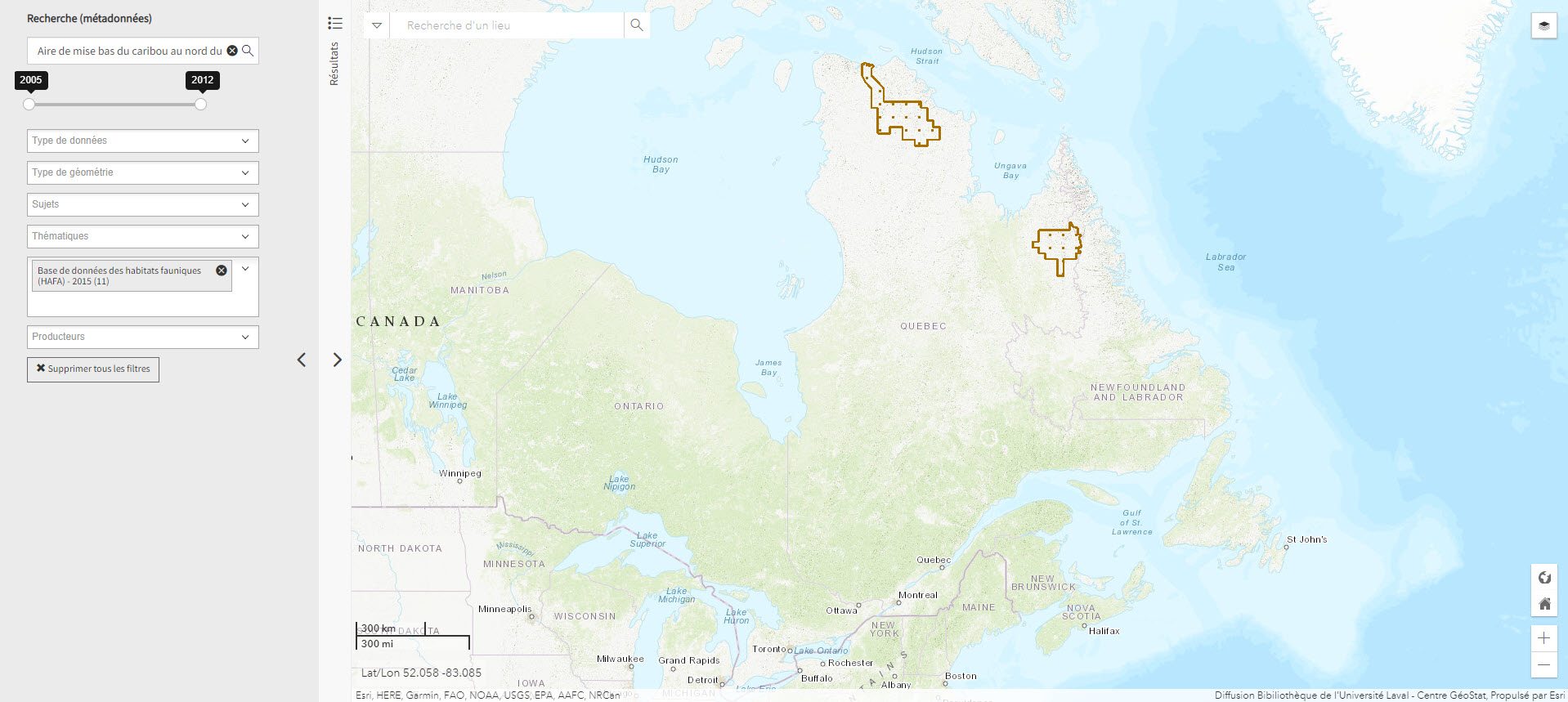
Modèles numériques d'altitude des villages nordiques à l'échelle 1/2 000 (Géoindex)
Concordia (Reserved Access) | INRS (Reserved Access) | Laval (Reserved Access) | McGill (Reserved Access) | UQAM (Reserved Access) | UQTR (Reserved Access)
Includes digital elevation models covering Inuit villages located north of the 55th parallel. The documents in this series are digital elevation matrices accurate to within one metre.
Collection(s): *** First Peoples of the North ***, Maps, Atlases, and Geospatial Data, Geospatial Data, Northern Quebec, *** Maps, Atlases and Geospatial Data ***, Geospatial Data, Northern Quebec
Reserved Access, Humanities and Social Sciences
Subjects: Indigenous peoples, Geospatial data, Inuit, Digital elevation model, Villages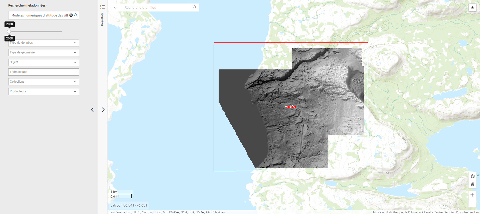
Nan bei ji di tu ji = Atlas of the Arctic and Antarctica
Atlas featuring polar projection maps of the Arctic and Antarctic, as well as regional maps of these areas. The reference work also examines research zones near the poles, in particular those where China is conducting research.
Collection(s): *** Maps, Atlases and Geospatial Data ***, Maps and Atlases, Circumpolar North
Print Document, Humanities and Social Sciences, Natural Sciences
Subjects: Atlas, Maps, China, Research
North Circumpolar Map (Gouvernement du Canada)
Polar projection map produced in 2016 indicating settlements, boundaries, transportation networks, glaciers, and national parks.
Collection(s): *** First Peoples of the North ***, Maps, Atlases, and Geospatial Data, Map and Atlases, Circumpolar North, *** General Public ***, Maps and Atlases, Circumpolar North, *** Maps, Atlases and Geospatial Data ***, Maps and Atlases, Circumpolar North
Free - Open Access, Humanities and Social Sciences, Natural Sciences
Subjects: Maps, Circumpolar North, Polar projection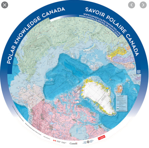
Northern Quebec (Environment Canada) (Environnement Canada)
Map depicting Indigenous lands, nations, and marine regions, as well as administrative regions, municipalities, and hydroelectric power plants.
Collection(s): *** General Public ***, Maps and Atlases, Northern Quebec, *** Maps, Atlases and Geospatial Data ***, Maps and Atlases, Northern Quebec, *** First Peoples of the North ***, Maps, Atlases, and Geospatial Data, Map and Atlases, Northern Quebec
Free - Open Access, Humanities and Social Sciences
Subjects: Indigenous peoples, Maps, Northern Quebec, Nunavik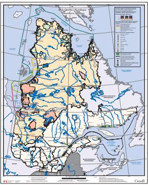
Nunavik: Inuit place name map series
BAnQ (Print Book) | Laval (Print Book) | McGill (Print Book)
Collection of large maps featuring traditional place names of places, lakes, and rivers Text in Inuktitut (syllabic fonts), English, and French.
Collection(s): *** Maps, Atlases and Geospatial Data ***, Maps and Atlases, Northern Quebec, *** First Peoples of the North ***, Maps, Atlases, and Geospatial Data, Map and Atlases, Northern Quebec
Free - BAnQ Subscribers, Print Document, Humanities and Social Sciences
Subjects: Atlas, Indigenous peoples, Maps, Northern Quebec, Nunavik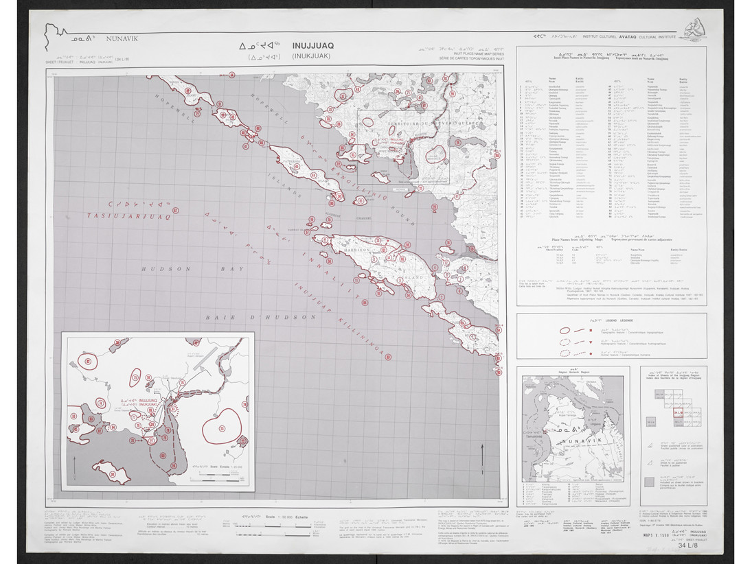
Nunavut Atlas
Concordia (Print book) | Laval (Print Book) | McGill (Print Book) | UQAM (Print Book)
Atlas depicting land and resource use as claimed by the Inuit as part of the process of the creation of Nunavut. Includes maps on the communities, wildlife, and geographic boundaries of the Inuit world.
Collection(s): *** First Peoples of the North ***, Maps, Atlases, and Geospatial Data, Map and Atlases, Northern Canada, *** Maps, Atlases and Geospatial Data ***, Maps and Atlases, Northern Canada
Print Document, Humanities and Social Sciences, Natural Sciences
Subjects: Atlas, Indigenous peoples, Maps, Borders, Inuit, Nunavut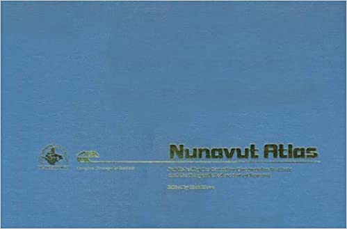
Orthophotographie noir et blanc des villages nordiques 1/10 000 (2004) (Géoindex)
Concordia (Reserved Access) | INRS (Reserved Access) | Laval (Reserved Access) | McGill (Reserved Access) | UQAM (Reserved Access) | UQTR (Reserved Access)
Set of 161 digital orthophotos representing northern villages (1:10,000).
Collection(s): *** First Peoples of the North ***, Maps, Atlases, and Geospatial Data, Geospatial Data, Northern Quebec, *** Maps, Atlases and Geospatial Data ***, Geospatial Data, Northern Quebec
Reserved Access, Humanities and Social Sciences
Subjects: Indigenous peoples, Inuit, Orthophotographs, Quebec, Villages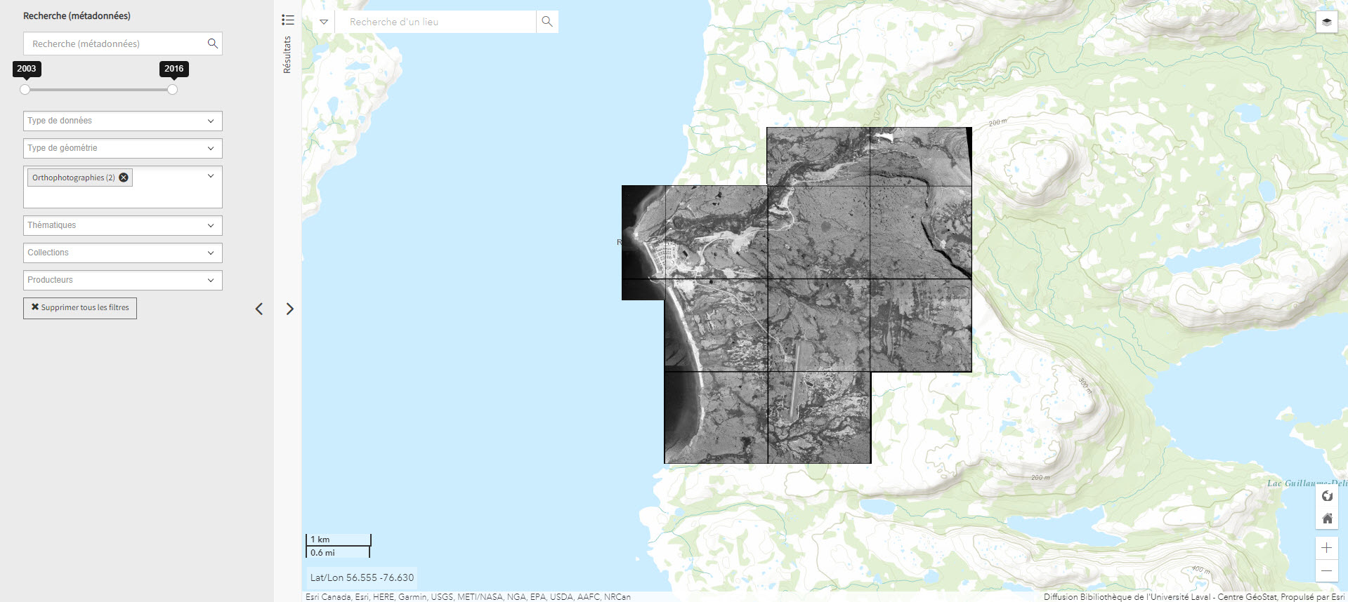
Pan Inuit Trails
Atlas showing Inuit occupancy of the Northwest Passage region, specifically traditional Inuit trails across the Arctic.
Collection(s): *** Maps, Atlases and Geospatial Data ***, Maps and Atlases, Northern Canada, *** First Peoples of the North ***, Maps, Atlases, and Geospatial Data, Map and Atlases, Northern Canada
Free - Open Access, Humanities and Social Sciences
Subjects: Indigenous peoples, Maps, Inuit, Northwest Passage, Trails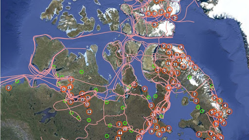
Parc national du Québec (Géoindex)
Concordia (Reserved Access) | INRS (Reserved Access) | Laval (Reserved Access) | McGill (Reserved Access) | UQAM (Reserved Access) | UQTR (Reserved Access)
Layer of geospatial data representing Quebec's provincial parks in the form of polygons, scale 1:100,000.
Collection(s): *** Maps, Atlases and Geospatial Data ***, Geospatial Data, Northern Quebec
Reserved Access, Natural Sciences
Subjects: Geospatial data, National parks, Quebec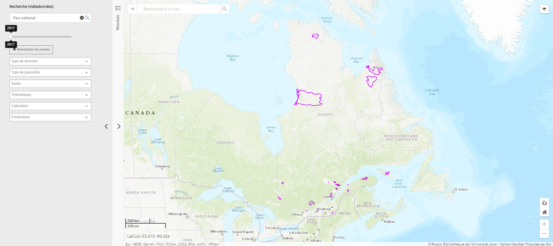
Plan Nord maps (BAnQ)
Collection of geographic and thematic maps (actives mines and mining projects, electricity generation, wildlife areas, vegetation zones, aboriginal communities, etc.) from the Plan Nord program, dedicated to the sustainable development and the enhancement of the resources of northern Quebec.
Collection(s): *** First Peoples of the North ***, Maps, Atlases, and Geospatial Data, Map and Atlases, Northern Quebec, *** General Public ***, Maps and Atlases, Northern Quebec, *** Maps, Atlases and Geospatial Data ***, Maps and Atlases, Northern Quebec
Free - Open Access, Engineering and Technology, Humanities and Social Sciences, Natural Sciences
Subjects: Indigenous communities, Energy, Mine exploration, Mining, Arctic fauna, Mines, Vegetation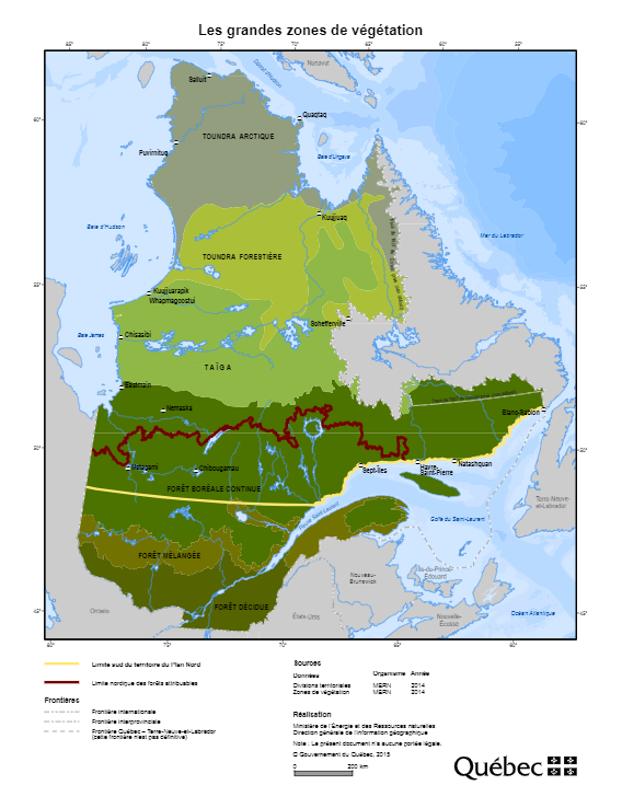
Polar data catalogue
A catalogue of metadata and polar data, including geospatial data, that describes and provides access to data generated by Arctic and Antarctic researchers.
Collection(s): *** Maps, Atlases and Geospatial Data ***, Geospatial Data, Circumpolar North
Free - Open Access, Free - Reference only, Engineering and Technology, Health Sciences, Humanities and Social Sciences, Natural Sciences
Subjects: Cartography, Geospatial data, Metadata, Circumpolar North, Research
Portail des données ouvertes - Arctique canadien (Gouvernement du Canada)
A selection of geographic maps of the Canadian North covering various topics.
Collection(s): *** Maps, Atlases and Geospatial Data ***, Geospatial Data, Northern Canada
Free - Open Access, Engineering and Technology, Humanities and Social Sciences, Natural Sciences
Subjects: Canadian arctic, Geospatial data, Northern Canada
Soil atlas of the Northern circumpolar region
Laval (Print Book) | UQTR (Print Book)
Atlas specializing in soils in the circumpolar North that looks at the composition, their classification and presentation of soils according to local perspectives, as well as how they are being impacted by climate change.
Collection(s): *** Maps, Atlases and Geospatial Data ***, Maps and Atlases, Circumpolar North
Print Document, Natural Sciences
Subjects: Atlas, Maps, Climate change, Soils
The Atlas of Canada – Toporama (Gouvernement du Canada)
National, regional, and local topographic maps.
Collection(s): *** General Public ***, Maps and Atlases, Northern Canada, *** Maps, Atlases and Geospatial Data ***, Maps and Atlases, Northern Canada
Free - Open Access, Humanities and Social Sciences, Natural Sciences
Subjects: Atlas, Maps, Topography, Toponyms